10 Features Of The iPhone Maps App That You Should Know
![]() We admit that Apple’s Maps app had a complicated start. The app that Google Maps tried to banish from iPhones had some troubles in the beginning. Five years later, it looks a little bit different, though. Apple improved the app continuously and included many practical features. Here are 10 features that you should definitely know.
We admit that Apple’s Maps app had a complicated start. The app that Google Maps tried to banish from iPhones had some troubles in the beginning. Five years later, it looks a little bit different, though. Apple improved the app continuously and included many practical features. Here are 10 features that you should definitely know.
1. Show traffic information
Do you want to know how the current traffic situation in your area looks like or how it looks like at your destination? Then you should activate the current traffic report. Tap the Info icon at the top right corner and set the slide button to green for the option Traffic.
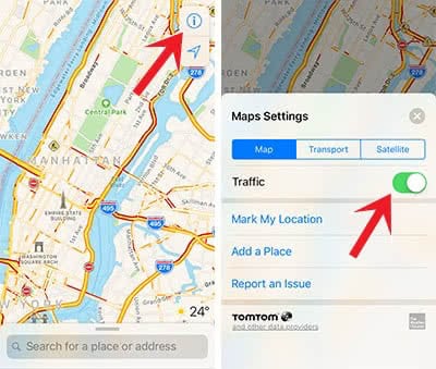
As soon as you activate the feature, it will show the traffic flow in yellow, orange or red on the map.
2. Select own route
The fastest route is not always the best choice. Therefore, the Maps app offers two alternatives to each route. After starting the directions to a destination, you will see three blue lines on the map that also shows the travel time for each suggestion.

Now you can select one route. The darker blue route will be the one that is used for the directions.
3. Avoid Toll Roads
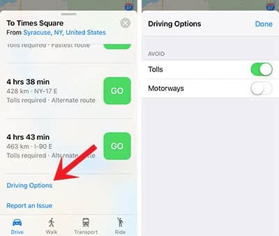
If you want to avoid toll roads, you can use the Maps app for this. Enter the destination and click Route. Swipe the button menu up and tap Driving Options. There you can select Toll Roads so that they will be avoided in the routing. You can also avoid Motorways if you want.
4. Create Favorites
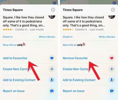
You can create Favorites for every place on the Maps app. Tap the location that you want to save and open the detailed info at the bottom. Scroll down to Add to Favorites. Then you can give the place a name such as “Work”, “Home” or “Great Parking Spot”. At the same place, you can remove the Favorite again.
5. Explore categories
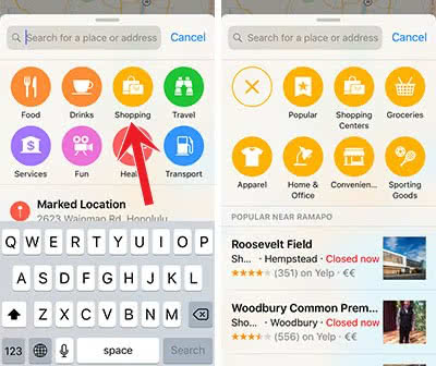
Instead of serching for specific places, you can also explore different categories, for example, Food, Drinks, Shopping or Travel. Just tap the search bar at the bottom and select the relevant button. There are even sub-categories to get the best results possible.
6. Start a Flyover Tour
Another great feature in Apple’s Maps app is the Flyover Tour. This option is available for big metropolis and virtually shows you the highlights of the city. You can start the Flyover Tour by searching for a city and then you will see the Flyover Tour below the name at the bottom.
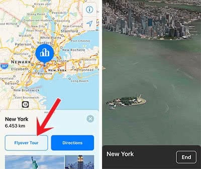
As it isn’t available for every region, Apple compiled all Flyover cities here.
7. Show Wikipedia information
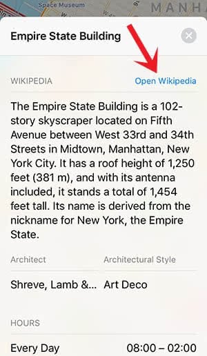
Apple Maps shows Wikipedia excerpts for popular sights. Tap the location on the map so that the details view opens up. After a little bit of scrolling, you will find the Wikipedia section. If you want to read the whole article on Safari, you can tap Open Wikipedia on the right.
8. Share location
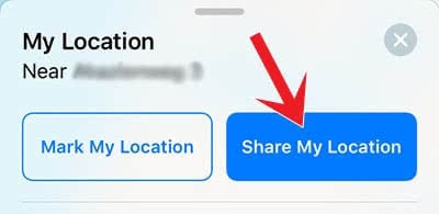
This feature is especially practical, if you want to share your location with your friend. To share your location, you have to tap the location pin on the map. Then click the Share My Location button and select the sharing method (message, email, Facebook, Twitter, WhatsApp, etc.).
9. Mark location
The same way, you can mark your location. This could be helpful, for example, for finding your parking spot again. To mark a location, you just tap Mark My Location in the detailed view of your location. You can always remove the marker again.

10. Using Siri
Siri doesn’t only change settings on your iPhone. Siri also can be a support for navigation. The command “Show me the traffic” will give you an overview of the traffic situation nearby. You can start getting directions by saying “Show me the way to…” or “Find me a good Italian place nearby”. Siri can also calculate the distance between two places with the command “How far is it to Las Vegas?”. If you ask her “What tourist attractions are nearby?”, Siri will list up the sights in the cities close to you.
