Offline Navigation – Navigate Without Internet
![]() As a diligent reader of our tips and tricks you should already know that you can use your iPhone as a navigation device (GPS). It is free and handy tool, because everyone is carrying the smartphone everywhere. You can just use the pre-installed Maps app on your iPhone for this. So it makes the purchase of an expensive GPS gadget unnecessary. The big disadvantage of Apple’s Maps app lies in the “online obligation” – no GPS without internet. We want to show you a method that allows navigation without internet on your iPhone – or in other words: Offline GPS!
As a diligent reader of our tips and tricks you should already know that you can use your iPhone as a navigation device (GPS). It is free and handy tool, because everyone is carrying the smartphone everywhere. You can just use the pre-installed Maps app on your iPhone for this. So it makes the purchase of an expensive GPS gadget unnecessary. The big disadvantage of Apple’s Maps app lies in the “online obligation” – no GPS without internet. We want to show you a method that allows navigation without internet on your iPhone – or in other words: Offline GPS!
Apple Maps app allows only online navigation
At first we want to give you some basic explanation about Apple’s Maps app. As mentioned before, the navigation with the pre-installed Maps app on your iPhone works only with a maintained internet connection. The reason is that the GPS receiver of the iPhone shuts off without internet. It is always possible to determine your location offline. However, the Maps app is lacking in the necessary maps material to visualize the location information graphically. This material is provided online and is not saved locally on your iPhone.
Navigation without internet
This is the reason why you need an app like CoPilot GPS – Car Navigation & Offline Maps, which allows an offline navigation, because it saves the maps material on your iPhone. You can download this app in the App Store for free.
When you open CoPilot GPS the first time, you will be prompted to sign up for an account by providing an email and password. But the registration can be made later as well. You can always go to MyCoPilot → Sign Up or Log In → Sign-Up in the menu.
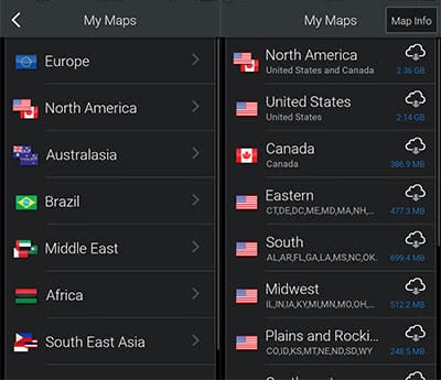
In the following step you can download a map of your choice. For our Canadian and U.S. American readers, we recommend the North America map (2.36 GB). You could also decrease the size by choosing certain regions like United States with 2.14 GB or just Eastern with 477.3 MB. If you are unsure, what you want to choose, you can click the “Map Info“ button in the right top corner. It will give you the details about each map download with the certain states and regions that are included in the maps. For the download you will need an internet connection and depending on the quality of it, the download could take a while.

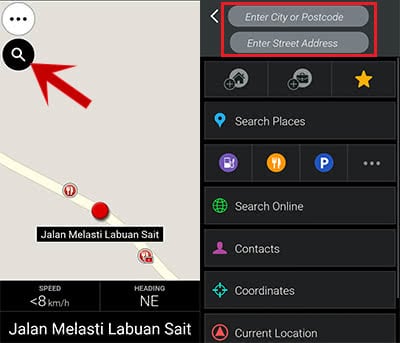
After you downloaded the map, tap the magnifier icon at the top left corner on the maps display. Then you enter the destination, which you want to head for.

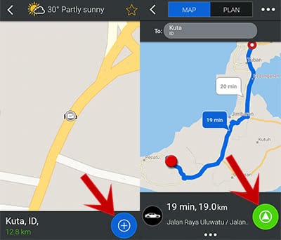
Afterwards tap the blue “+“ button at the bottom right to get an overview on the planned route with alternative route suggestions. At the bottom you will see the expected time, the distance, and the highways that you would need to take. You can start the navigation by clicking the green arrow button at the bottom right.

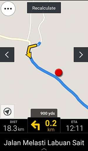
You will get the notification that you can purchase an upgrade to use the fully automated navigation with spoken notifications for turns, in order to be less distracted while driving. You can click “No, thanks…” at the bottom, if you do not want to purchase it. This way you just use the basic functions of the app. Once you decided, the navigation starts!

As an alternative to the CoPilot GPS app you can also use the Google Maps app offline on your iPhone. We explain in our article “How to Use Google Maps Offline Mode on iOS” how it works!
